Bathymetric Lake Mapping
Bathymetric Lake Mapping
When it comes to our aquatic environments, there are many factors that come into play as to what determines their long-term sustainability as healthy bodies of water and navigable waterways. With over 15 years of Marine Specialty Construction experience, we at Superior understand this and are your go to company to provide you with the required, long term solutions.
Most often this entails removing accumulated sediment from the body of water via either mechanical or hydraulic dredging.
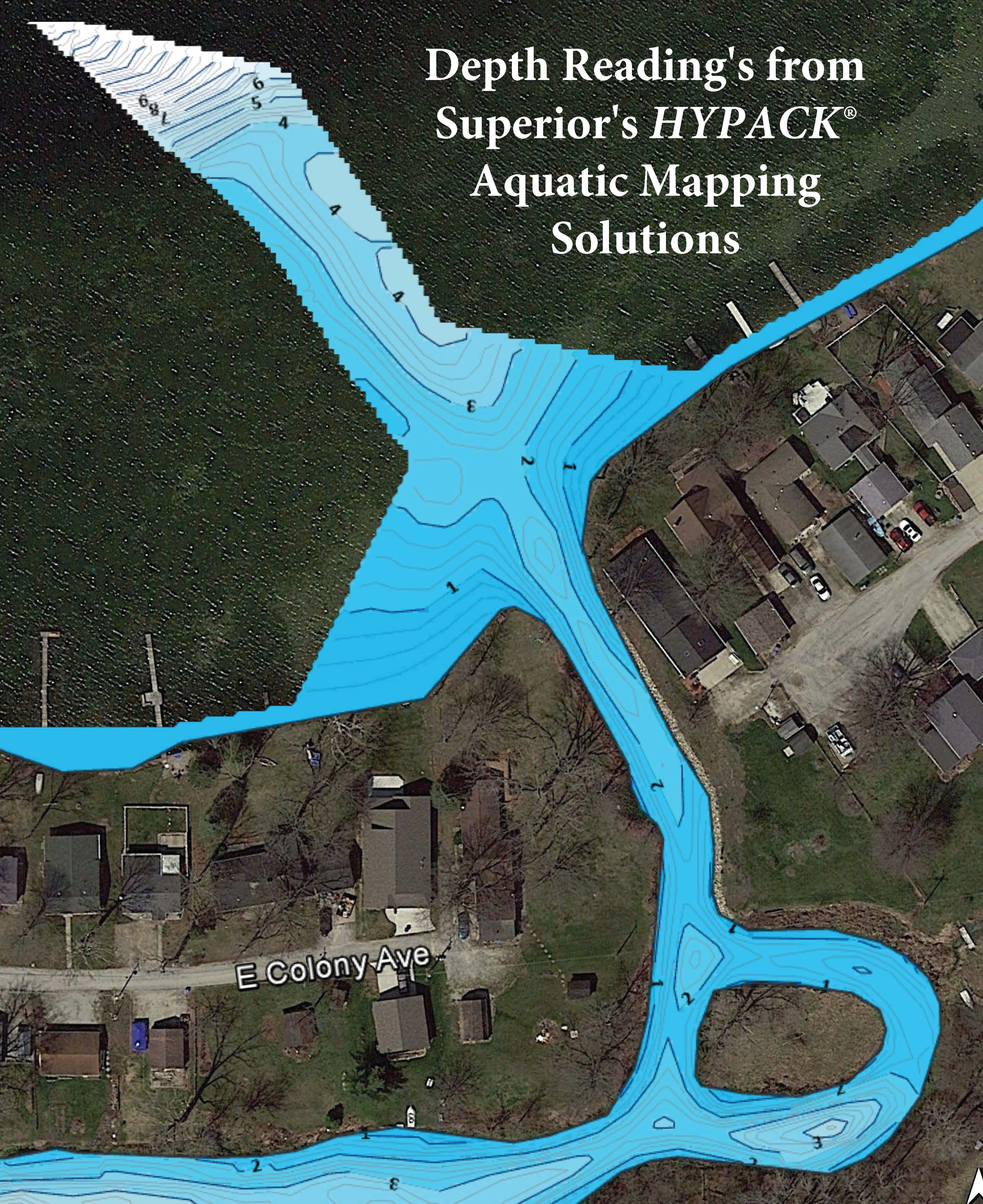
Superior’s HYPACK® Mapping Solution is the first step in the dredging project. This will determine the current depth of the proposed dredging area, the contours of the marine environment bed, and the particle makeup of the soil or marine bed. Once the survey is complete, the factors determining the project can be analyzed and the dredging depth and methodology can be decided.
Our HYPACK® Mapping Solution deploys the most technologically advanced Echo Sounder, combined with our state of the art GPS Bathymetry 3-D imaging software. Our system allows us to provide you with a fully customizable mapping of either the entire body of water or a specific part thereof.
Rest assured that you will be receiving the most accurate reading available at any price.
Superior’s HYPACK® Mapping Surveys Offer:
Mapping the bottom contours of lakes, marinas ponds, rivers & reservoirs
Pre-dredging and post-dredging surveys
Monitoring lake sedimentation
Underwater obstructions / site investigations
Bottom core sampling and testing
Volume calculations
If you are planning any type of marine related construction, regardless of what it involves. Contact us today and allow us to share with you our experience and the many solutions we provide.